sailing TOUCAN
and recreational cruising:
See our River Navigation page for our free, educational, YouTube videos on navigation and sailing.
We cruised and raced a new Catalina 25 for 23 years from 1979 until 2002. Most of our time was inland but we did cruise between Port St. Joe and Destin, Florida for up to one week with two to four people aboard. Our 25′ x 8′ sleept: 1 Luxuriously, 2 Comfortably, 3 Possibly, 4 Very Good Friends, 5 Tightly and 6 Obscenely. The afterbirth had to sleep two but the central bunk only had a 16″ headroom. Using a Sun Shower on the deck to bathe and washing cloths in a bucket was not the best but we were young and foolish.
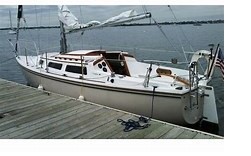 Catalina 25
25′ x 8′ x 5′ (w/ Board down)
200 Sq Ft.
Tiller steered
9.9 Hp outboard
Our Catalina 28 MKii is obviously much bigger and has a hot and cold shower in the head and on the aft swim platform plus an LP gas cook-top and oven. She can actually sleep six comfortably with a couple in the Vee birth, two singles in the main saloon and a couple in the aft master stateroom.
Catalina 28 MKii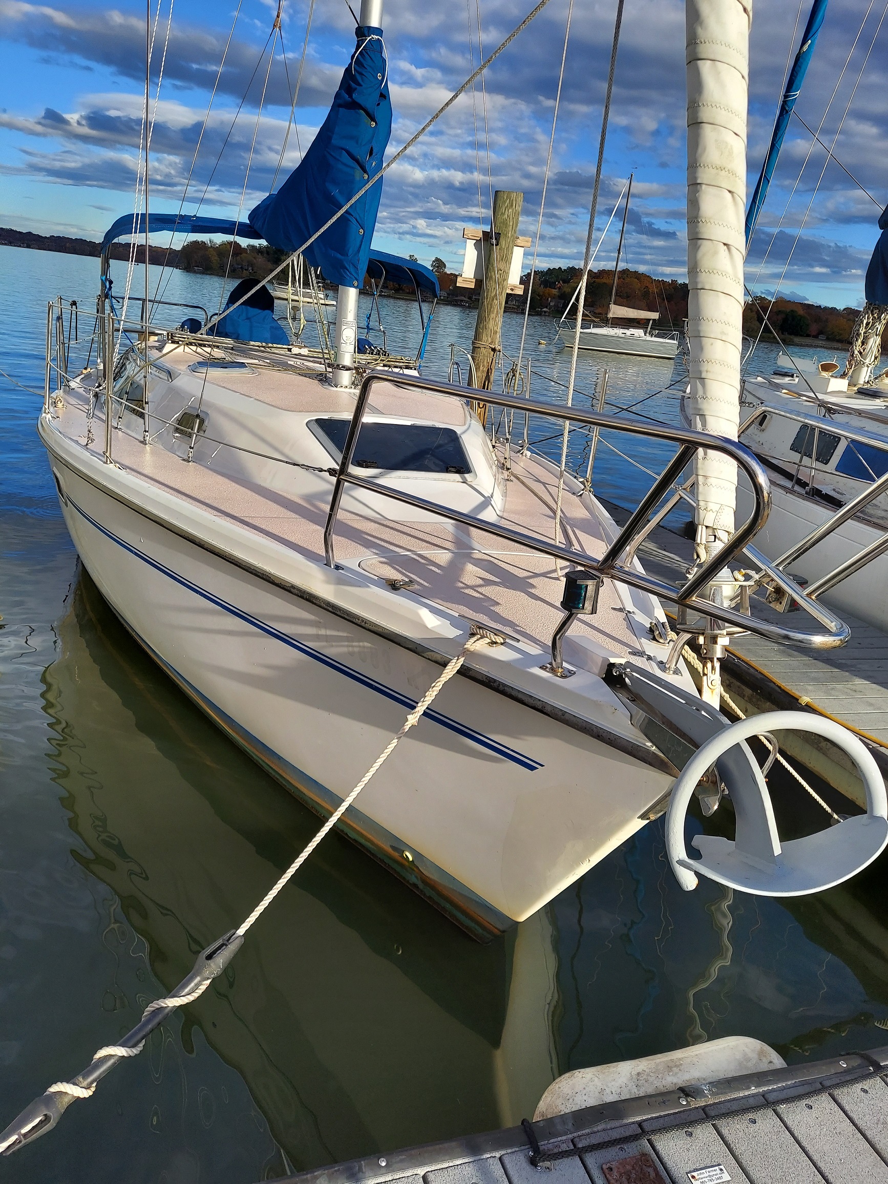
29’5″ x 10’4″ x 3′ 7″ Wing keel
301 Sq Ft cabin
Wheel steered
26 Hp Universal/Westerbeke diesel
19 gallons of fuel, 19 gallons of black water 45 gallons of potable water(two tanks) and additional jerrycan water
Powered range 200+ miles at 5+ mph and we carry 5 gallons of jerrycan diesel.
25# Rockna anchor with aluminum Danforth as backup
OpenCPN on a Raspberry Pi Microprocessor & TV as monitor plus battery and tank level monitor in the saloon.
Our most popular YouTube video is 4 OpenCPN Overview that describes this FREE, excellent, chart potting software and how to use it.
 It can be very useful for a recreational boater or a commercial captain.
OpenCPN utilizes free, OFFICIAL. NOAA, Electronic Navigation Chards, ENCs or Corps of Engineers IENC river charts plus the Coast Guard buoy database.
Routs planned on OpenCPN can be exported via SD card to your helm-mounted GPS plotter as GPX (GPS data interchange) files.
It can access and display vessel AIS data from an AIS receiver plus it can provide a radar overlay from your radar.
You can overlay a chart with imported GRIB weather files for route GO / HOLD decisions based on weather windows.
I successfully used OpenCPN aboard a K-Boat (305-passenger, 87′), passenger vessel, as our primary chart plotter for marine navigation with Coastis approval.